
Long before University Parks was laid out with Victorian avenues and manicured lawns, these 70 acres were shaped by thousands of years of human activity. The site has been settled since at least the Bronze Age, with rich archaeological evidence revealing its ancient use for ritual, funerary, and agricultural purposes. Today, the University's many buildings border the Parks, offering both historic and modern architectural views beyond the boundaries.
Prehistoric traces and ritual grounds
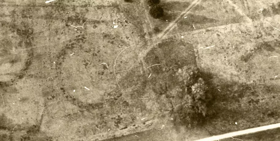
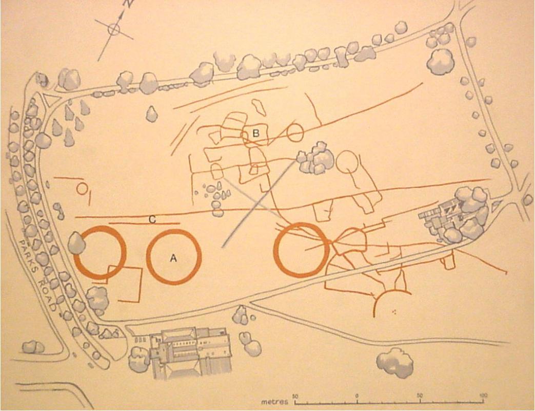
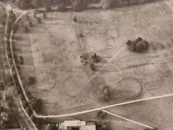
The Parks sit on a natural bed of terrace gravels. Where prehistoric communities dug ditches, burial mounds, and boundary trenches, the soil layer is deeper and retains moisture longer. During dry spells, the grass growing over these soil-filled earthworks stays darker, greener, and lusher than the surrounding turf, outlining ancient structures directly onto the grass, called crop marks.
What do the crop marks show?
Bronze Age Barrow Cemetery
The three distinct circular rings marked (A) form part of a Wessex-type Linear Barrow Cemetery, in use from the early second millennium BC through to the second century AD.
Romano-British Farmsteads
The surrounding ring ditches mark the working boundaries of early farming settlements that spanned the Cherwell floodplain across two thousand years.
Archaeological Finds
Human remains and everyday tools belonging to these early farming communities were discovered directly across the road during excavations in front of the Oxford University Museum of Natural History in 1970.
Medieval farmland
By the Middle Ages, the function of the land had become primarily agricultural, defined by rich farming pasture and river meadows. Owned by Merton College from the 13th century as part of the Manor of Holywell, the site was regularly leased to local tenant farmers for livestock grazing and haymaking.
Along the eastern boundary, the narrow strip of land following the River Cherwell – now known as Mesopotamia Walk – has an even longer working history. It housed watermills dating back to the Domesday Book of 1086, anchored by the historic site of King’s Mill.
Civil War defences & 'Newe Parkes'
During the English Civil War (1642–1646), when Oxford served as the Royalist capital for King Charles I, these peaceful fields took on a vital military role. Major trenches, earthworks, and defensive positions were dug across the terrain. In fact, the name 'Parks' originates from this era, referring directly to the 'park of artillery' stationed on the open land.
Despite the conflict, the area retained its personal appeal. Local records note that King Charles I regularly walked across the fields for exercise during the Siege of Oxford, accompanied by his greyhounds. It was during this turbulent period, in 1642, that University historian Brian Twine first officially recorded the name ‘Newe Parkes’.
Early leisure
By the 17th century, the fields were already being used for informal recreation. Maps and drawings from the 18th century depict farming and public leisure taking place side by side across the meadows.
Formal negotiations with Merton College to purchase the land began in 1853. The University acquired an initial 20 acres (8 hectares) in 1854, setting aside four of those acres as the site for the University Museum, which was constructed between 1855 and 1860. Realising that it possessed a significant amenity for sport and recreation, the University moved to enlarge the Parks. Over the next five years, a further 72 acres (29 hectares) extending towards the River Cherwell were purchased, along with a four-acre (1.5-hectare) spur towards King's Mill where Mesopotamia Walk was laid out in 1865.
A transforming landscape
The landscape in the 19th century appeared vastly different from today. River meadows provided grazing for sheep and cattle right up until 1937, and working farmland surrounded the Museum. According to an original surveyor's report, the site held just 251 trees when purchased – 190 willows, 59 elms, one oak, and one poplar. Today, University Parks boasts a living arboretum of over 1,600 trees.
Sport and Science
Between 1864 and 1902, dedicated space in the Parks was allocated to University clubs for cricket, rugby, tennis, croquet, hockey, and lacrosse, while local citizens continued to use the grounds freely for informal recreation.
Although it was initially expected that the University Museum would provide sufficient teaching and laboratory space for science, rapid growth in scientific disciplines required additional facilities. The Clarendon Laboratory was built on site in 1868, followed by the new Astronomical Observatory on Parks land between 1873 and 1875. Development continued along South Parks Road into the early 20th century, with post-World War I pressure mounting as Britain sought to keep pace with scientific development in Germany.
Building on the University Parks stopped towards the end of the 20th Century, and the boundary of the Parks is probably now fixed. It remains an important recreational open space close to the Oxford city centre, valued by both the University community and local residents.
Buildings around the University Parks
There are many University buildings visible from the University Parks, from very old to very new. These include:
Along the Science Area (Southern Boundary)
Oxford University Museum of Natural History: The dramatic neo-Gothic roofline and spires rise above the tree line along the southwest border.
Clarendon Laboratory & Beecroft Building: Major Physics department structures framing the Parks Road and South Parks Road corner.
Department of Biochemistry: Contemporary glass-fronted research facilities running along the southern edge.
Sir William Dunn School of Pathology: Framing the southeastern perimeter towards St Cross Road.
Bordering Colleges (Northern & Western Edges)
Lady Margaret Hall: The red-brick college buildings and grounds directly adjoin the northern boundary near the river.
Keble College: Situated directly opposite Keble Gate on Parks Road; its distinctive Victorian polychrome brickwork and Chapel spire are clearly visible looking west.
Linacre College: Located adjacent to the South Lodge entrance at the junction of South Parks Road and St Cross Road.
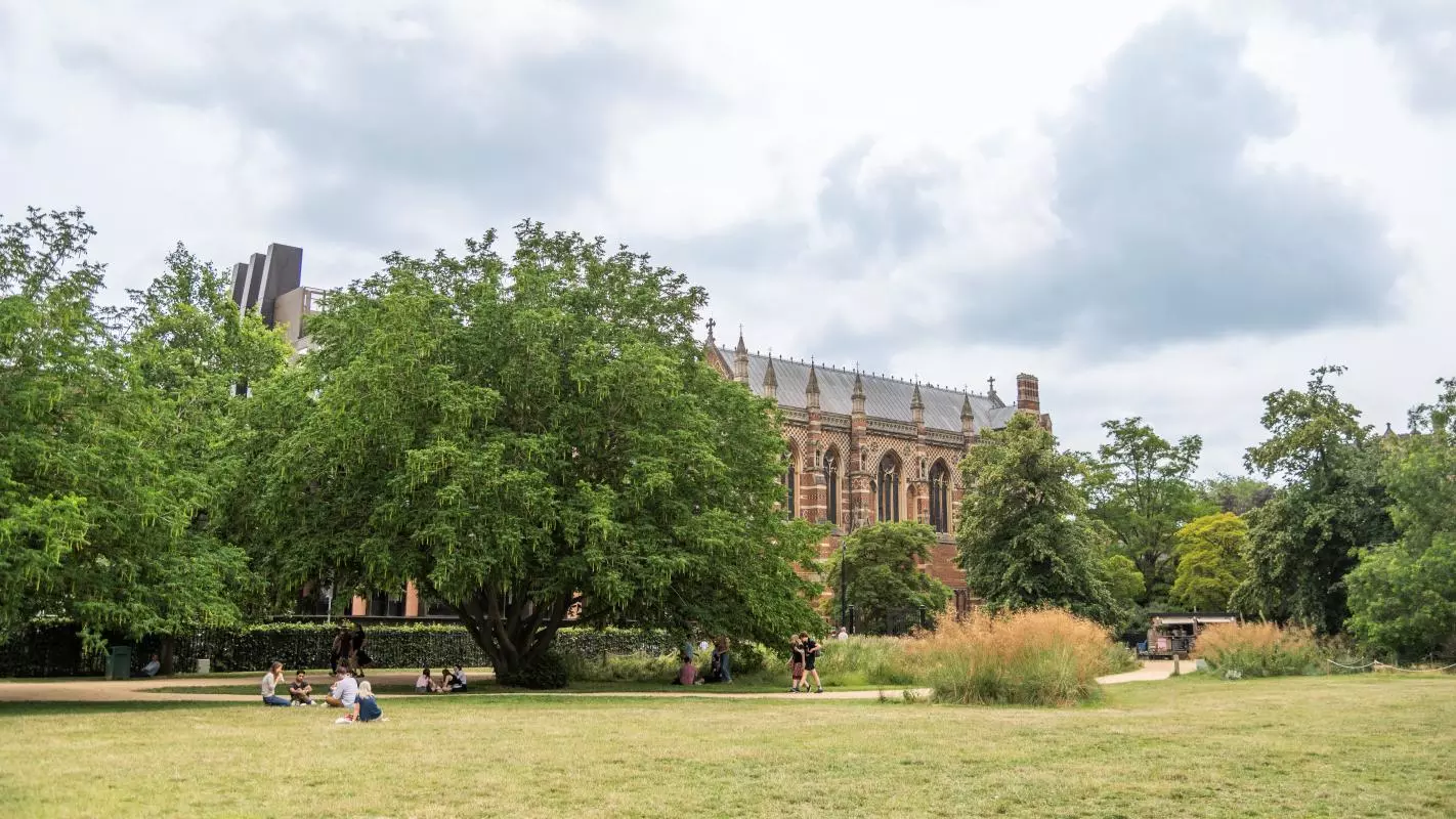
Views towards Keble College
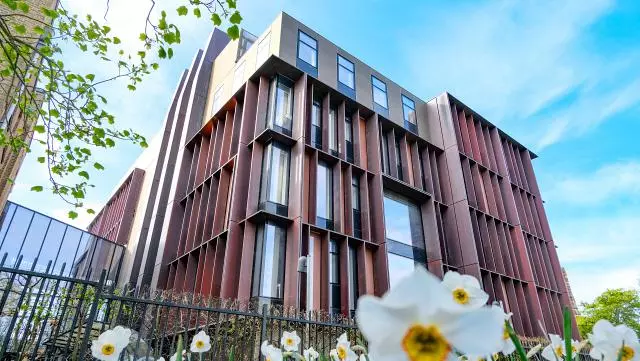
The new Beecroft Building